Burford Lane Aqueduct
preparation: Video of aqueduct flooding during Storm Christoph on 20/01/2021
(10 minutes & 15 seconds, best viewed full screen, quality dependent on bandwidth)
Background
This page was created to outline to WBC and other stakeholders the issues around Burford Lane Aqueduct, and reduce the number of vehicles being damaged by being driven through flood water.
WBC were fantastic, and:
- Replaced / reinstalled the flood depth gauges on either side of the aqueduct
- Committed to replacing the flood warning system in mid 2022; there is a flood detection system that activates flood warning signs on each side of the aqueduct, turns the traffic lights permanently red, and alerts WBC so that clean up processes take place. The system only activates when water levels reach ~10-20cm - vehicles driving through water at this depth have been observed to suffer (likely catastrophic) engine damage. There is a recurring theme of vehicles ignoring the flood warnings, jumping the red lights & becoming stuck
- Committed to enhanced gully clearing in the surrounding area (WBC do appear to be struggling on occasion with this one, conversations are ongoing!).
As at early 2025 this page is being updated to reflect changes since ~2021 and facilitate any remedial works.
4k version of same video as above (likely to be hardware and bandwidth dependent)
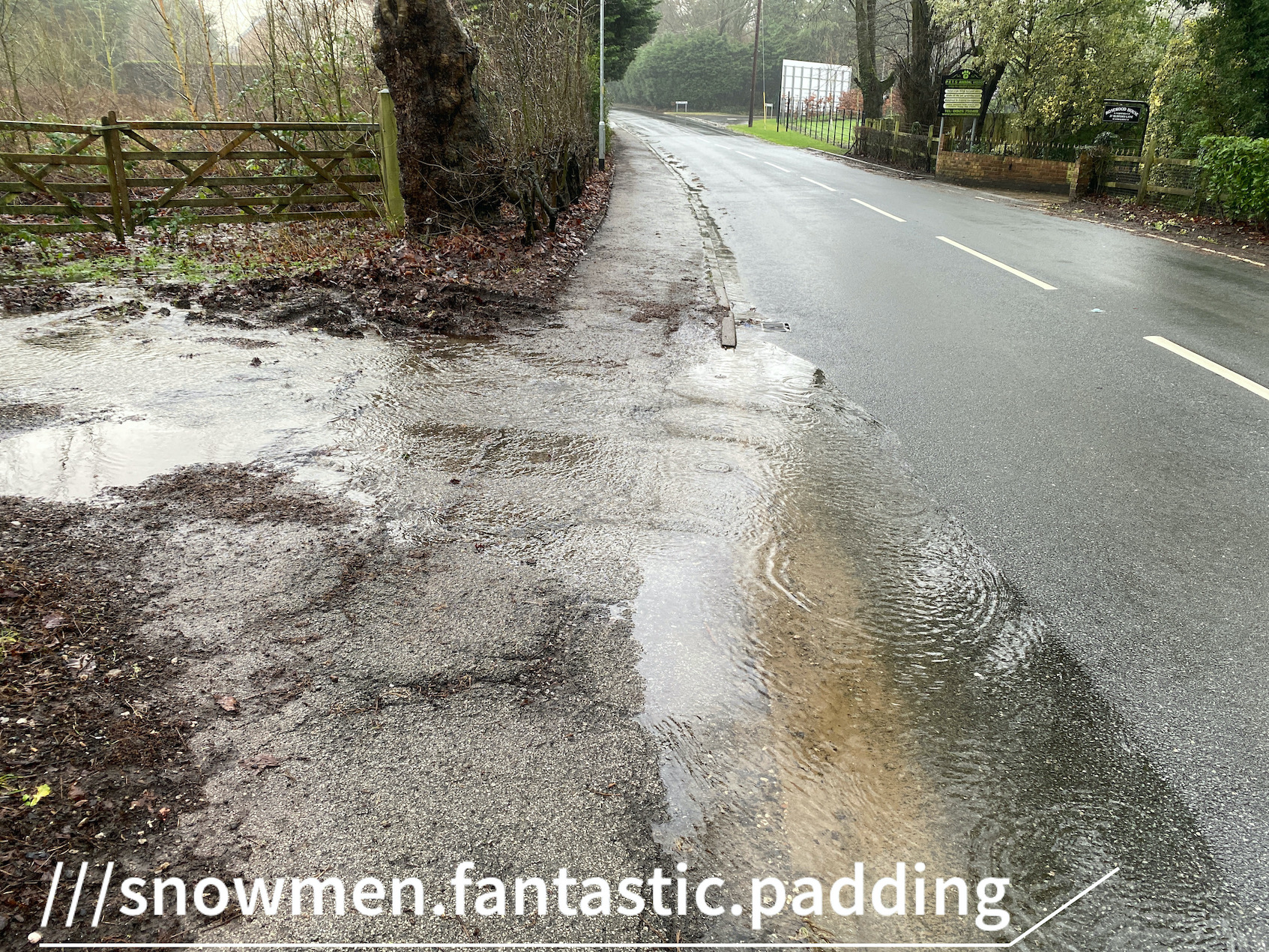
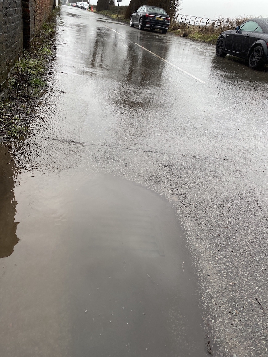
1. Impact of flooding
Occurrences where the aqueduct has flooded (to near pavement depth / 2.5 feet / enough to enter a car engine)
It is expected there are more - e.g. the local garage, Warburtons reported that vehicles often break down and are recovered a short distance from the aqueduct, or limp home but with severe damage.
- 05/01/2025 from approx 21:30, after ~20mm of rain in the previous 12 hours, flooded due to the volume of water entering over the wall from Spud Wood. Appears to have cleared overnight, but flow increased on the morning of 06/01/2025. Situation complicated by subsequent snow / freezing conditions. Road re-opened on 09/01 around midday (was clear pior to this, but with significant ice on the road). No evidence of any vehicles damaged.
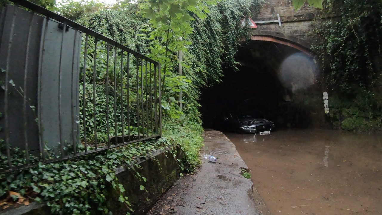
- 01/01/2025 - 70mm rain in 24 hrs, flooded to well over 1.2m, two cars stranded in the aqueduct for several days. Severe overflow from Spud Wood culvert entrance (root cause). Road closed for 2.5 days, re-opened at approx midday on 03/01/2025. WBC confirmed the flood alert system activated intermittently from 31/12/2024 21:00hrs, and permanently from 21:20hrs until 05:00hrs on 02/01/2025. The road was cleared, swept and re-opened 03/01/2025 from midday
- 18/12/2024 - flooded, both gullies within aqueduct blocked / barely draining (leaving standing water). Reported to WBC but not cleared as at 31/12. Red car broken down on Mill lane side. Multiple vehicles observed passing through and then suffering engine disruption, though managing to drive away.
- 05/12/2024 - flooded
- 19/11/2024 - high vehicle stuck against roof of aquduct at evening rush hour (travelling north).
- 30/09/2024 - flooded
- December 2023 - drainage improvement works at Spud Wood, improving drainage into the culvert system under the aqueduct
- 10/01/2023 - flooded
- 19/07/2022 - lorry stuck under aqueduct 14:30hrs
- 05/05/2022 - flood detection systems, new flood warning signs & sync with Traffic Lights installed (tested & 'live' a few weeks later) - managed by WBC, with live alerting.
- 20/02/2022 - partial flood.
- 08/12/2021 - flooded
- 20/01/2021 - flooded
- 08/08/2021 - flooded mid morning following approx 38mm rain falling in previous 3 hours. 3 cars were towed out
- 28/01/2021 – Flooded from early morning to approx. 11:30am. No vehicles believed damaged. Reported with WBC case ref. 111076
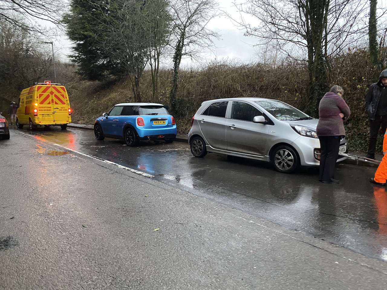
- 20/01/2021 – storm Christoph – flooded at around 13:00 hrs. Believed that 5 cars were towed out (flooding of the aqueduct likely inevitable due to the volume of rain)
- 14/01/2021 – flooded following heavy overnight rain. One car towed out. Reported, no case ref. provided.
- 16/06/2020 – flooded the second time in two days, at least one car towed out
- 15/06/2020 – flooded with very heavy rain in the evening, motorbike with flooded engine after passing through.
- 09/02/2020 – Storm Ciara, flooded am, two cars towed out
- 10/12/2019 – flooded, at least one car towed out
- 12/11/2019 – flooded
- 07/11/2019 – flooded, at least one car (a people carrier) towed out
- 31/07/2019 – flooded, at least one car towed out
- 19/07/2019 – flooded, at least one car towed out
examples from above:
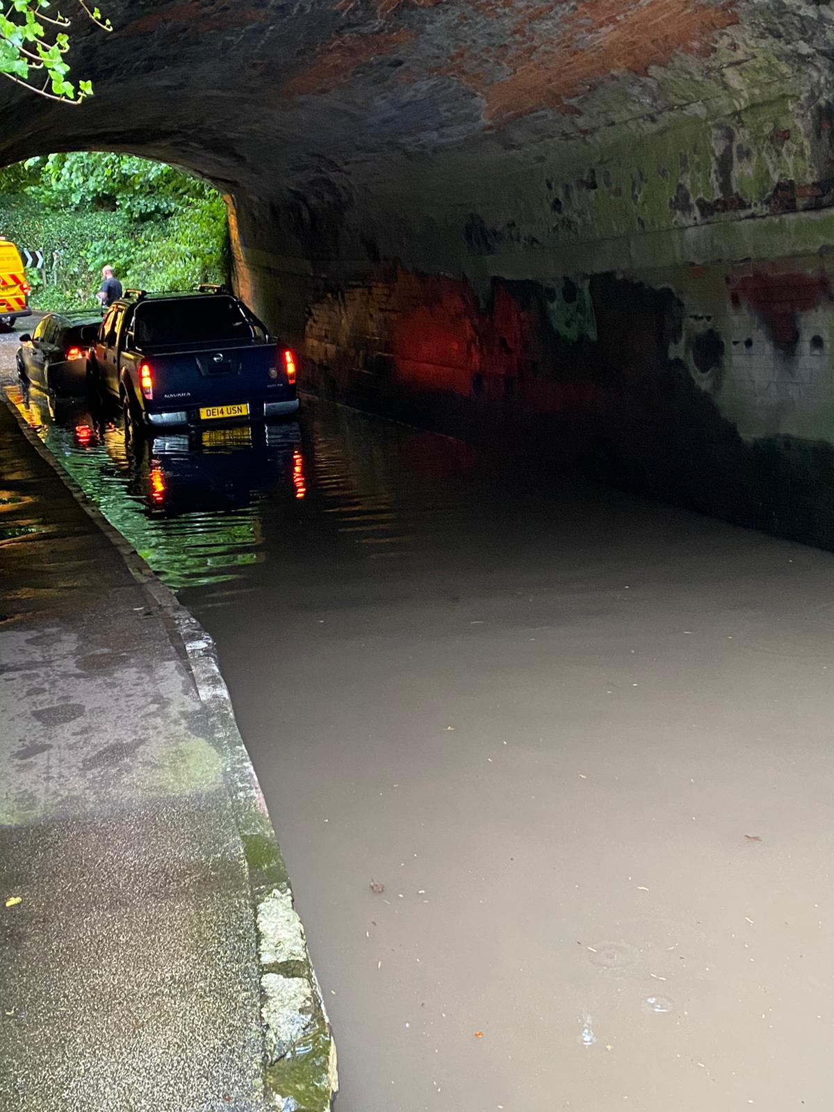
08/08/2021 three vehicles towed out:
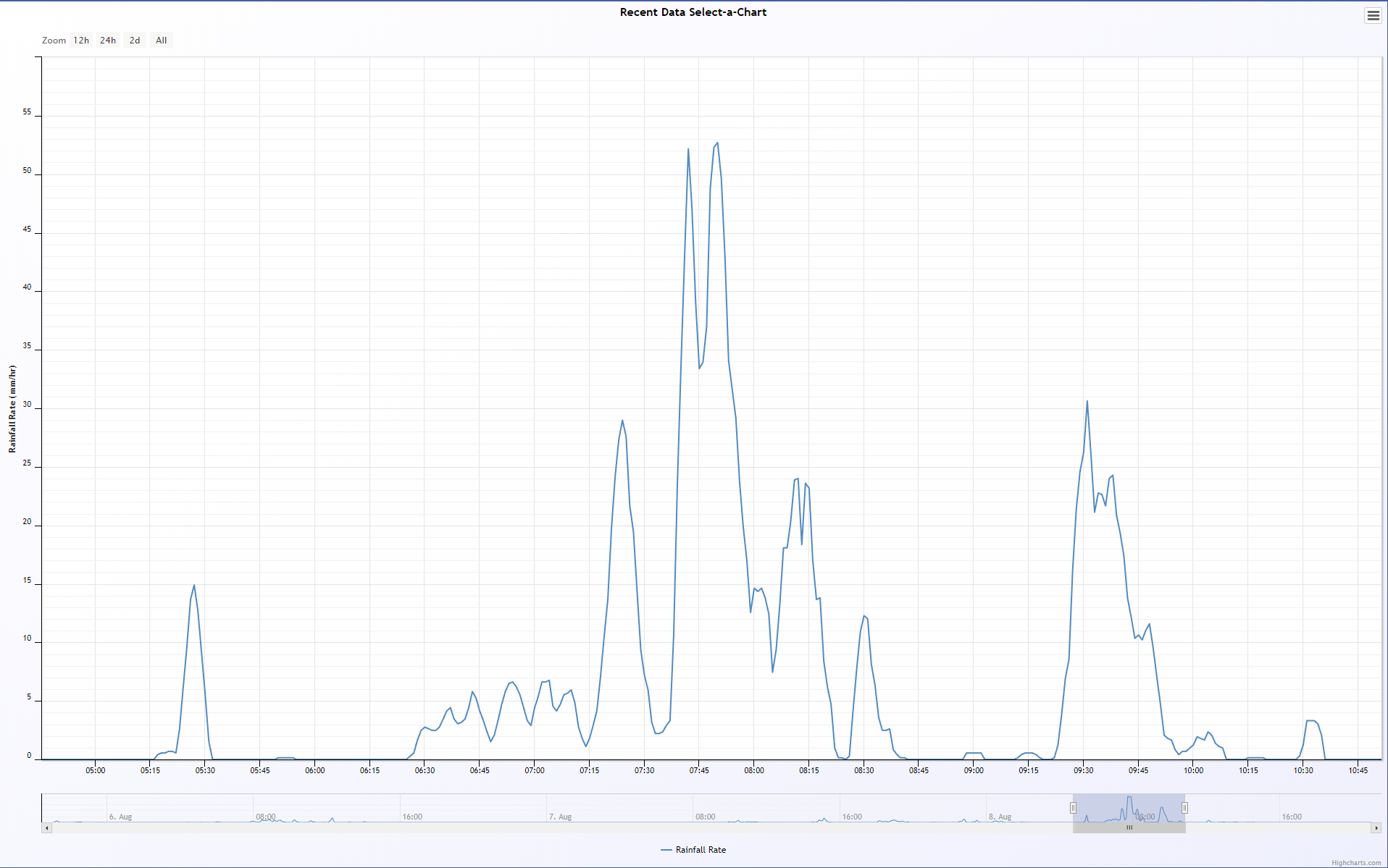
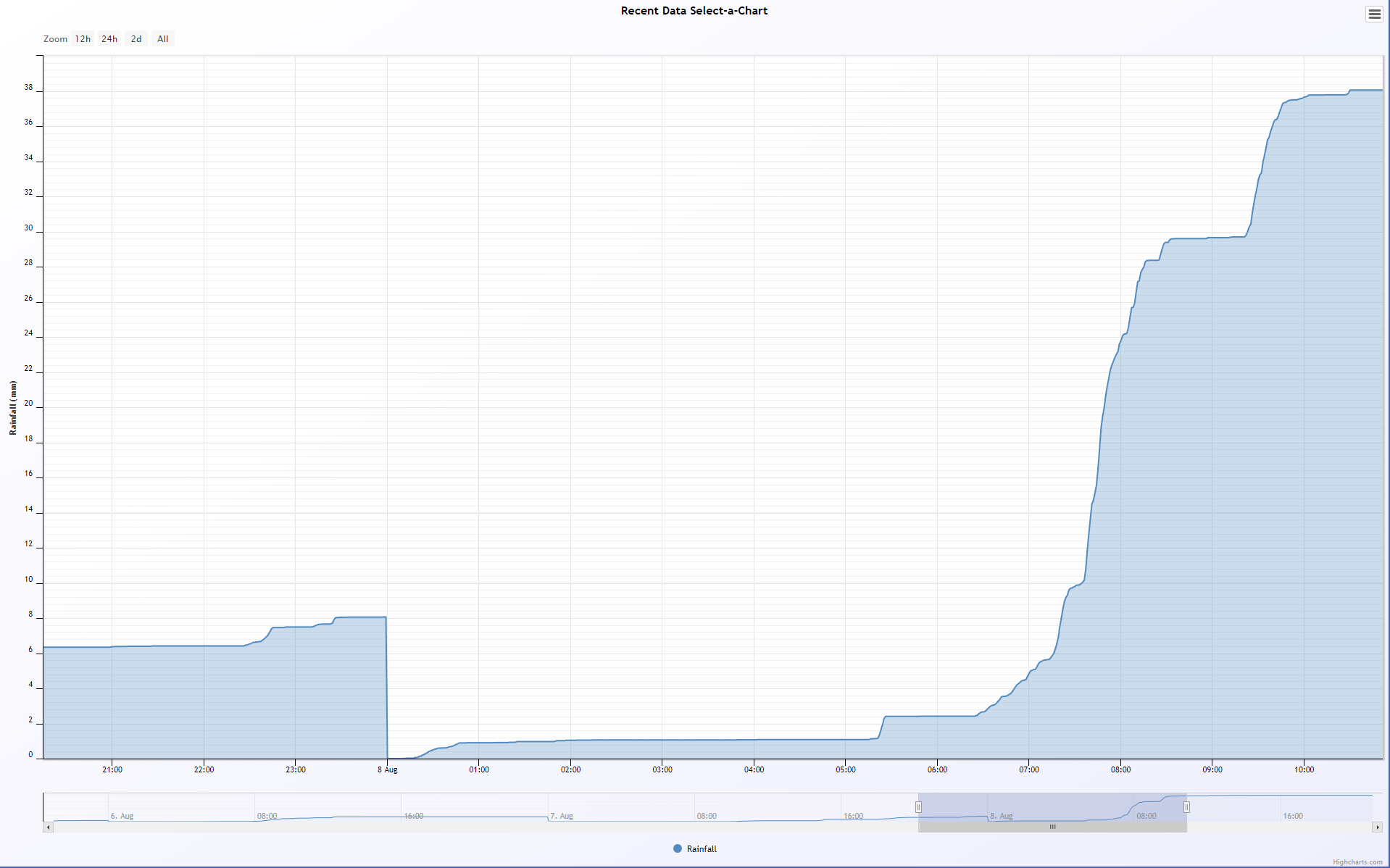
08/08/2021 rainfall volume & rate:
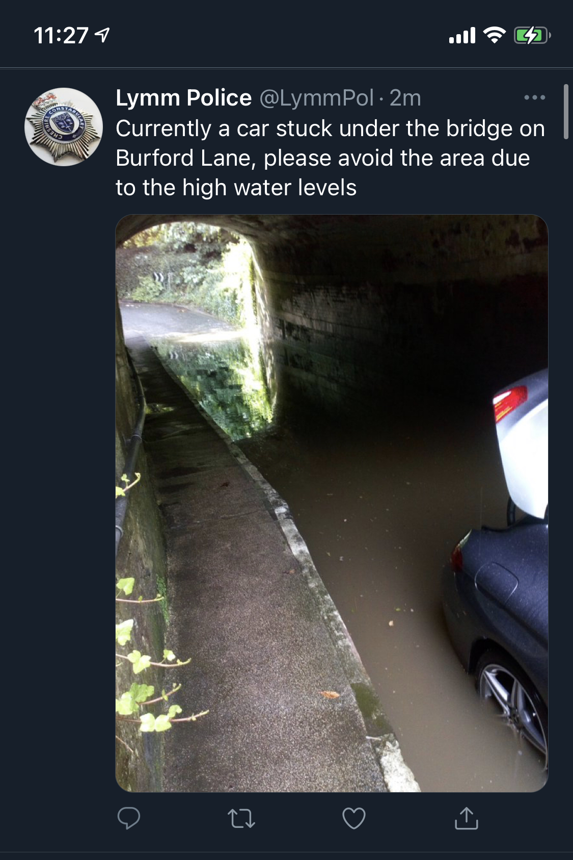
20/01/2021 two cars awaiting recovery:
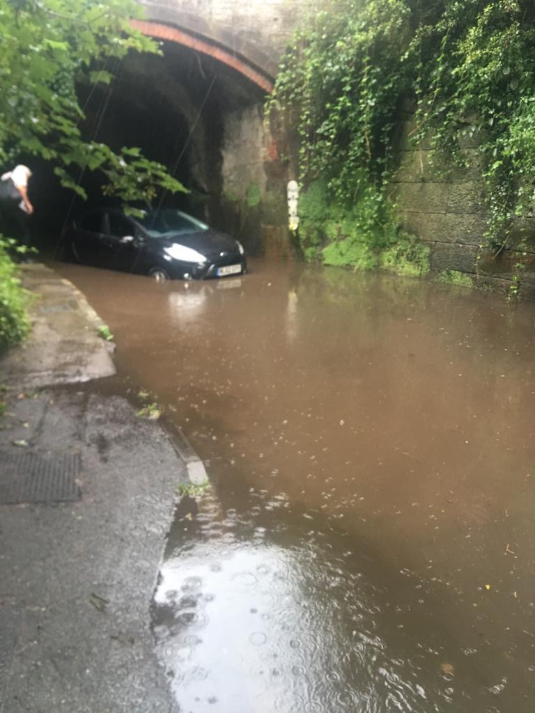
19/07/2019 car flooded:
2019 car flooded:
(13 x cars & one motorbike across just over 18 months are listed above) Whilst the above events are documented with a high degree of confidence, there may be additional events that have not been recorded here. Other known flooding events (again there may be more) are:
- 14/06/2016 - flooded, car stranded, ambulance & fire service attended at approx. 17:15hrs, Warrington Guardian & photo record
- 09/01/2016 – flooded, (Cheshire Police)
- 26/09/2012 - possibly flooded, Warrington Guardian
- 12/08/2008 – flooded, car stranded, reported in Warrington Guardian
2. Causes of the aqueduct flooding
- Rainfall - heavy, prolonged, typically on already saturated ground
- Water run-off from a few key locations
- Water running in from Burford Lane, source is multiple locations up to 1km up Burford Lane.
- Water running in from Stage lane, water is running for approx 400m along Stage lane
- Water running of the fields either side of the lower 1/3 of Burford lane
- From ~2022, substantially more water flowing in from the area around the footpath through Helsdale Woods, following the use of a large field changing from pasture (grass) to arable farming, e.g. increased run-off.
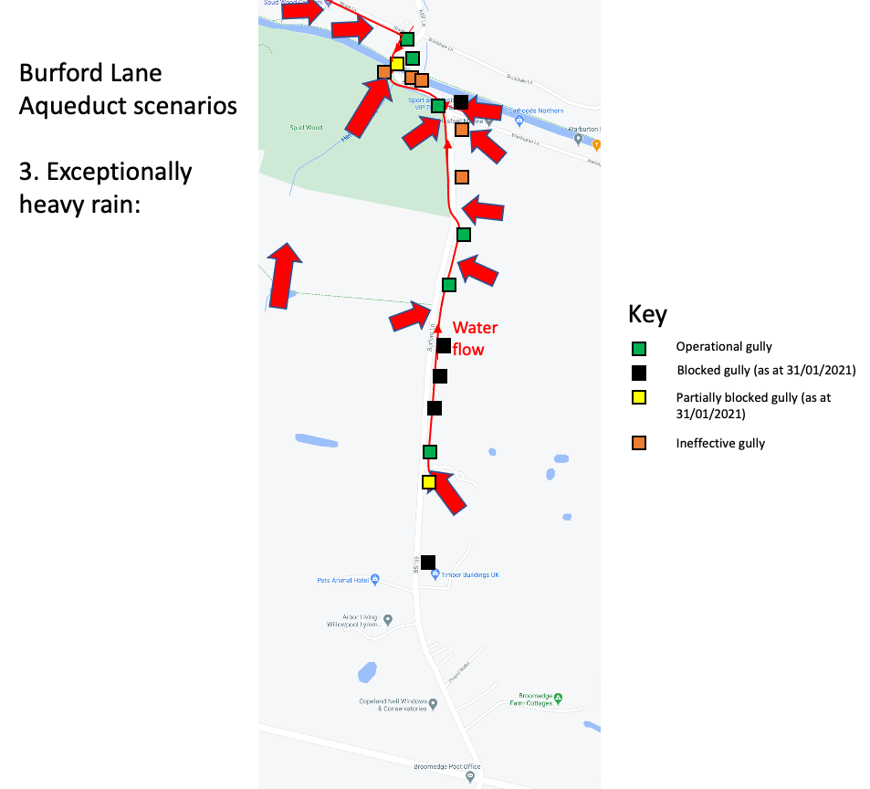
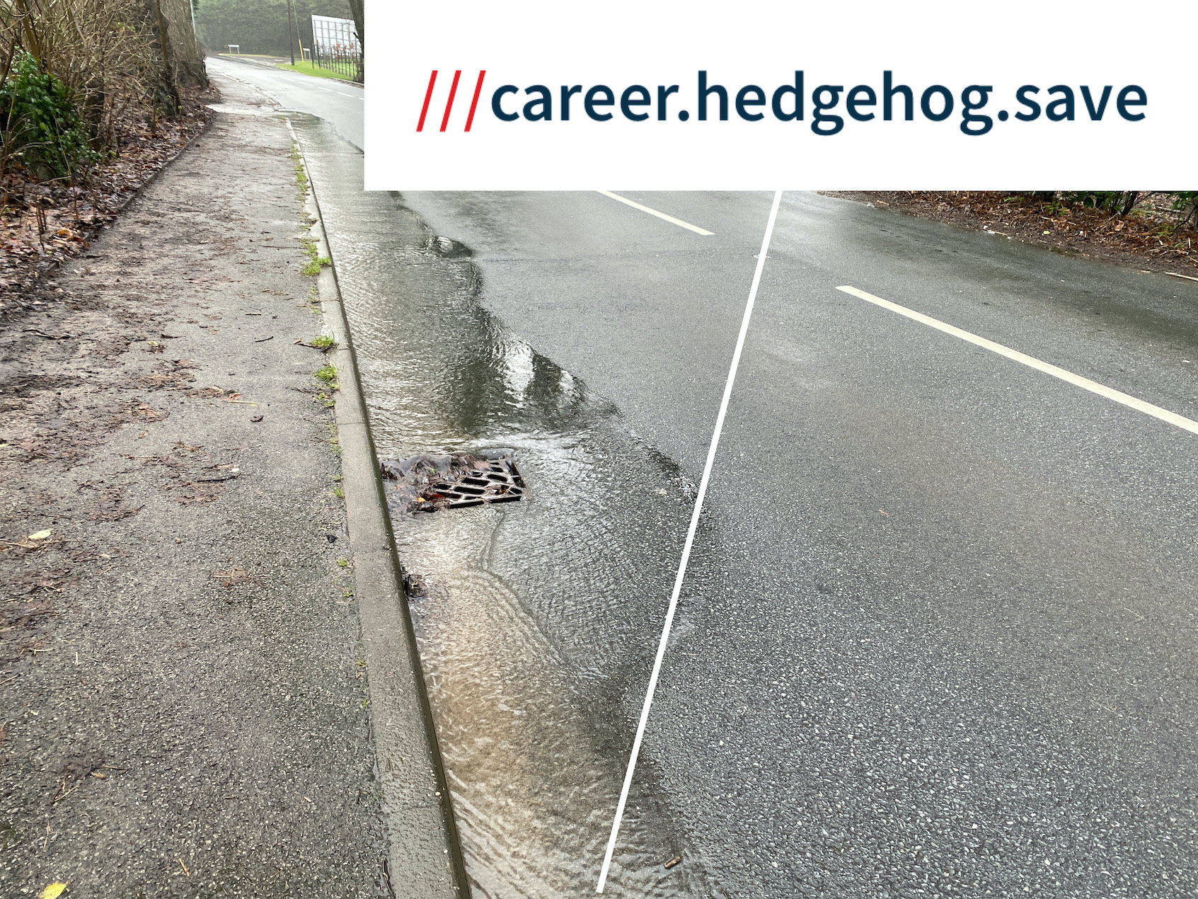
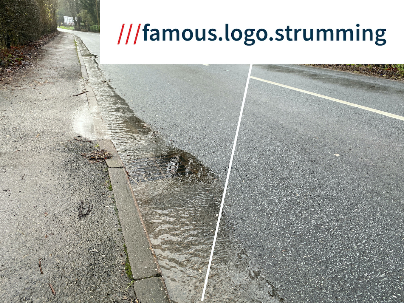
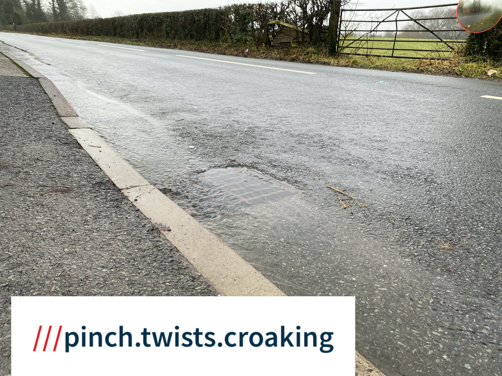
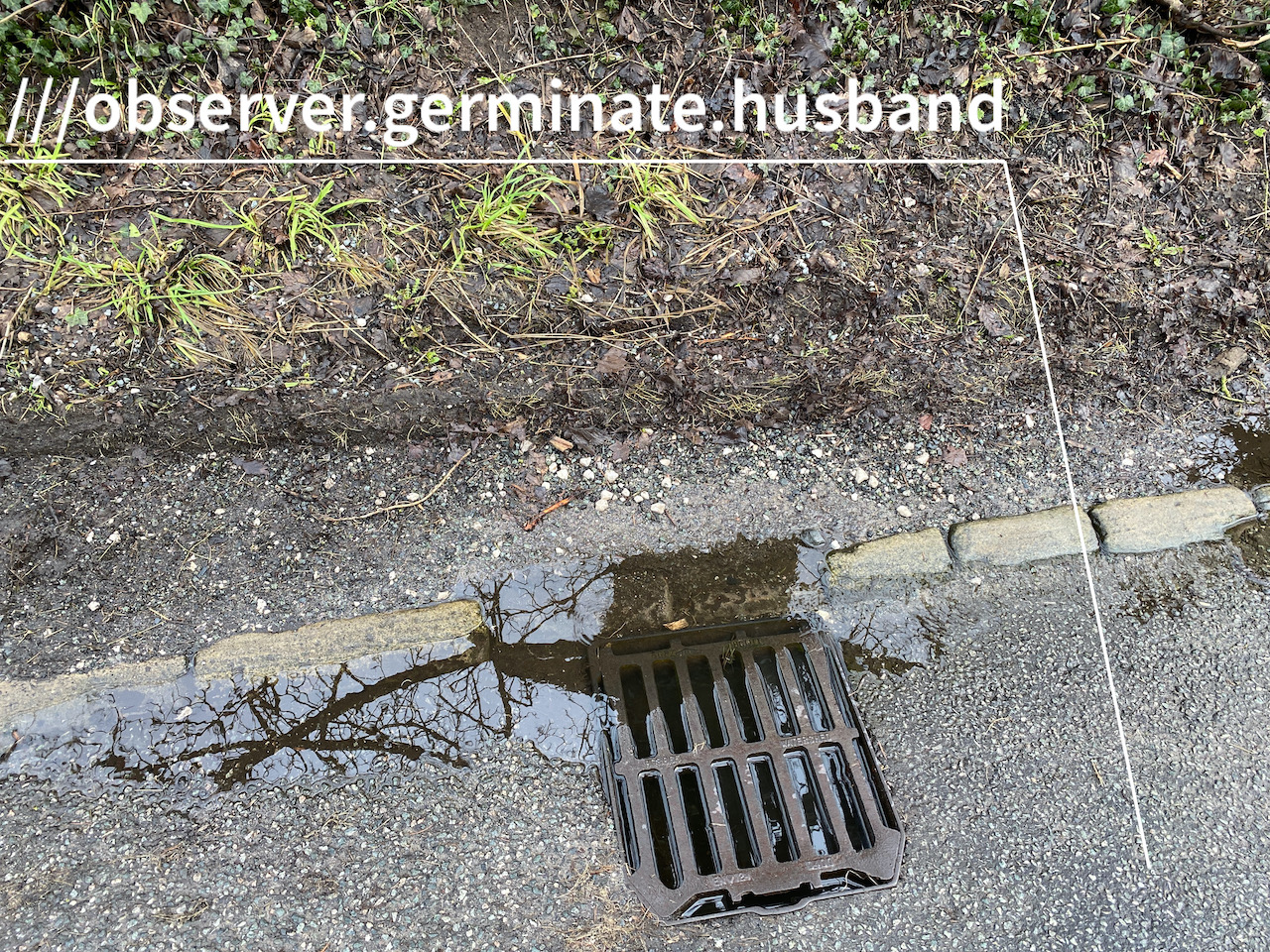
- Blocked and backed up gullies on Burford Lane, Warrington Lane & Stage lane
- Temporary blockages e.g. leaves & debris (particularly within the aqueduct)
- Longer term blockages e.g. silt / gullies not connected?! (legacy issue with gullies possibly not connected, according to WBC contractors)
- Volume of water entering the aqueduct, debris blocking the drainage system
- (exceptional - only observed on 20/01/2021 and 01/01/2025 - water pouring over the wall from Spud Wood, unable to enter the culvert system & instead entering the aqueduct faster than it could drain
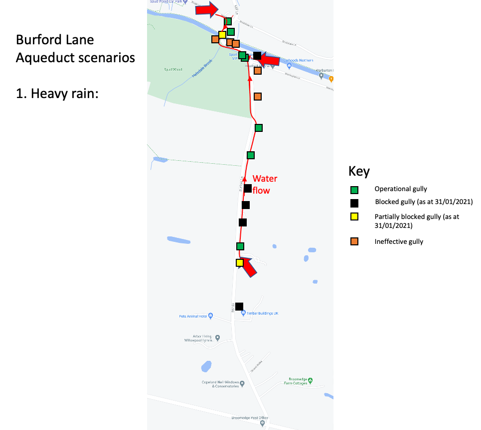
3. Water flow, gully status (approx)
3.1 After 'heavy' rain
3.2 after 'very heavy' rain
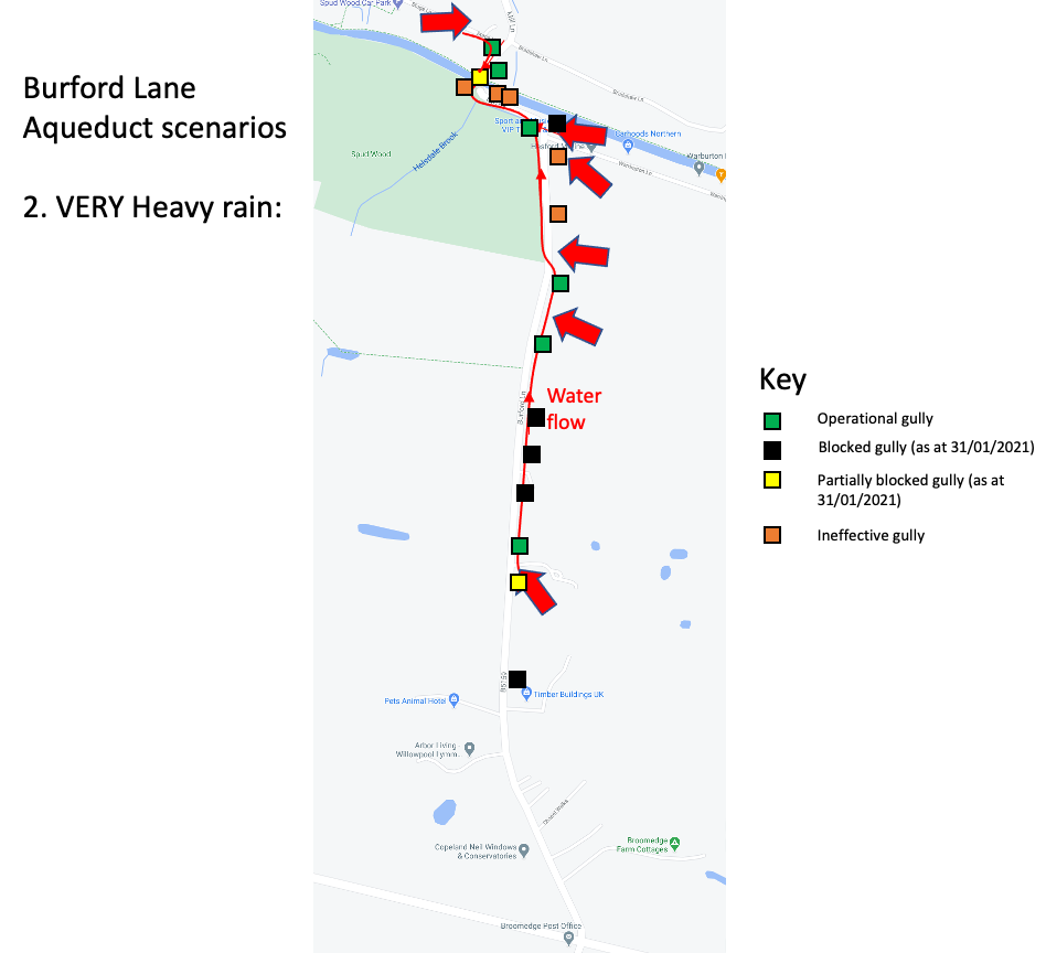
3.3 after 'exceptionally heavy' rain
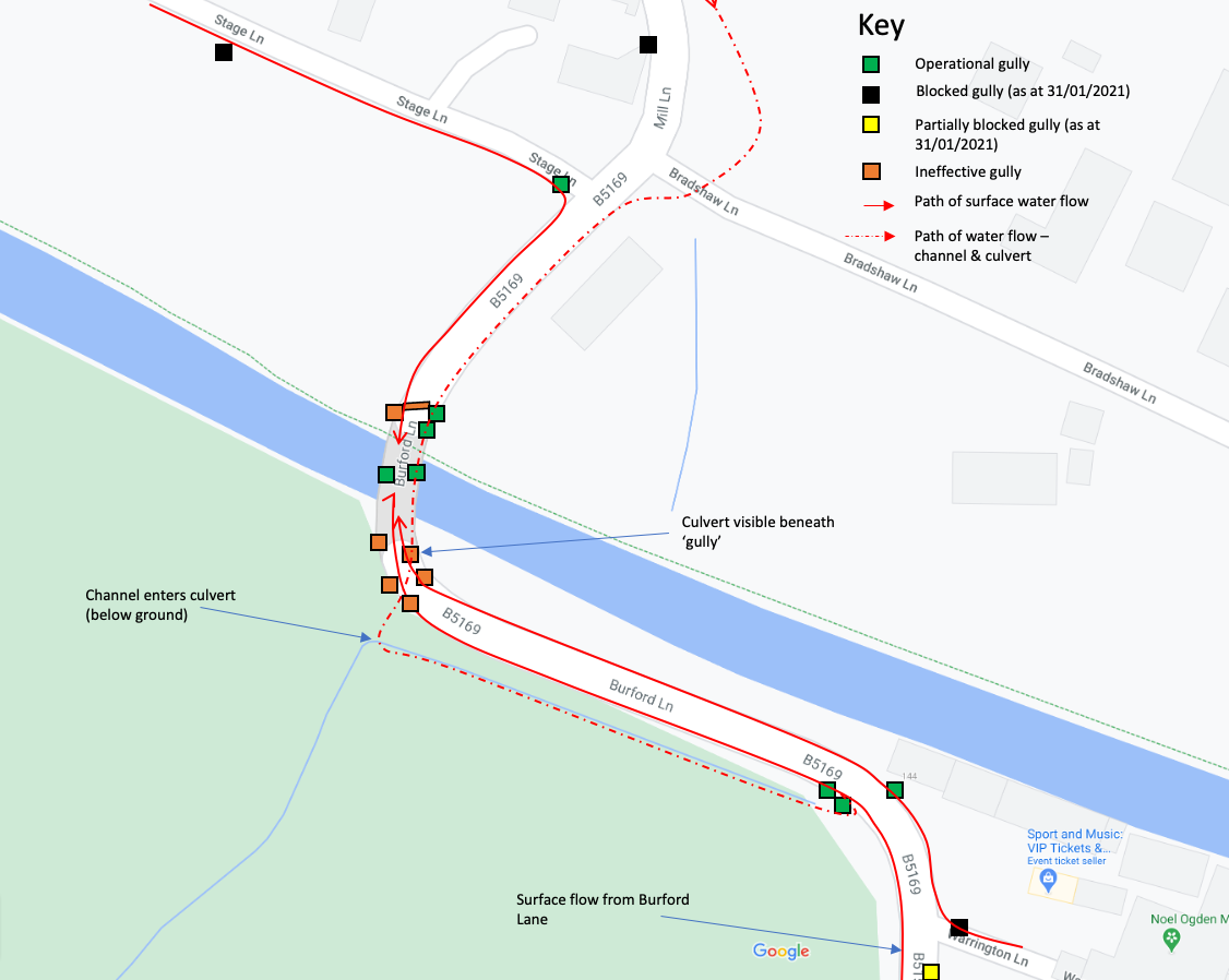
3.4 immediate aqueduct area
4. Water from Burford Lane (running approx 1km down the Burford Lane) - 31/01/2021 after rain had eased, whilst aqueduct still flooded.
4.1. Above Broomedge nursery, looking south (uphill):
4.2. Broomedge nurseries entrance, looking south (uphill)
4.3. Below Broomedge Nurseries, looking south (uphill)
4.4. outside no. 54 Burford Lane, looking south (uphill)
4.5. Outside no. 66 Burford Lane, looking south (uphill)

4.6. Outside Burford Lane Farm looking south (uphill)
4.7. Corner of Warrington lane & Burford Lane, looking east (towards the Barn Owl)
4.8 Stage lane (approx 350m west of Mill lane) - 06/02/2021
5. Maintenance
5.1 Blocked gullies
- Issues when reported not actioned
- No feedback = has it been dealt with or not, likely other issues (as an example - the gully below no. 94 Burford Lane not was connected to anything?! - connected late Oct 2020 then blocked with leaves 2 weeks later (by 5th Nov 2020)
- See 4.4, 4.5, 3.6 above (cleared on 14th Jan 2021 - visibly clear but not doing much).
- See 4.7 above - reported multiple times via WBC ref (& date reported / acknowledged) - gully on corner of Warrington Lane / Buford lane ref. 5.7 above:
a) CRM 928888 03/06/2020
b) CRM 942992 28/10/2020
c) CRM 947374 17/01/2021
d) CRM 948757 03/02/2021
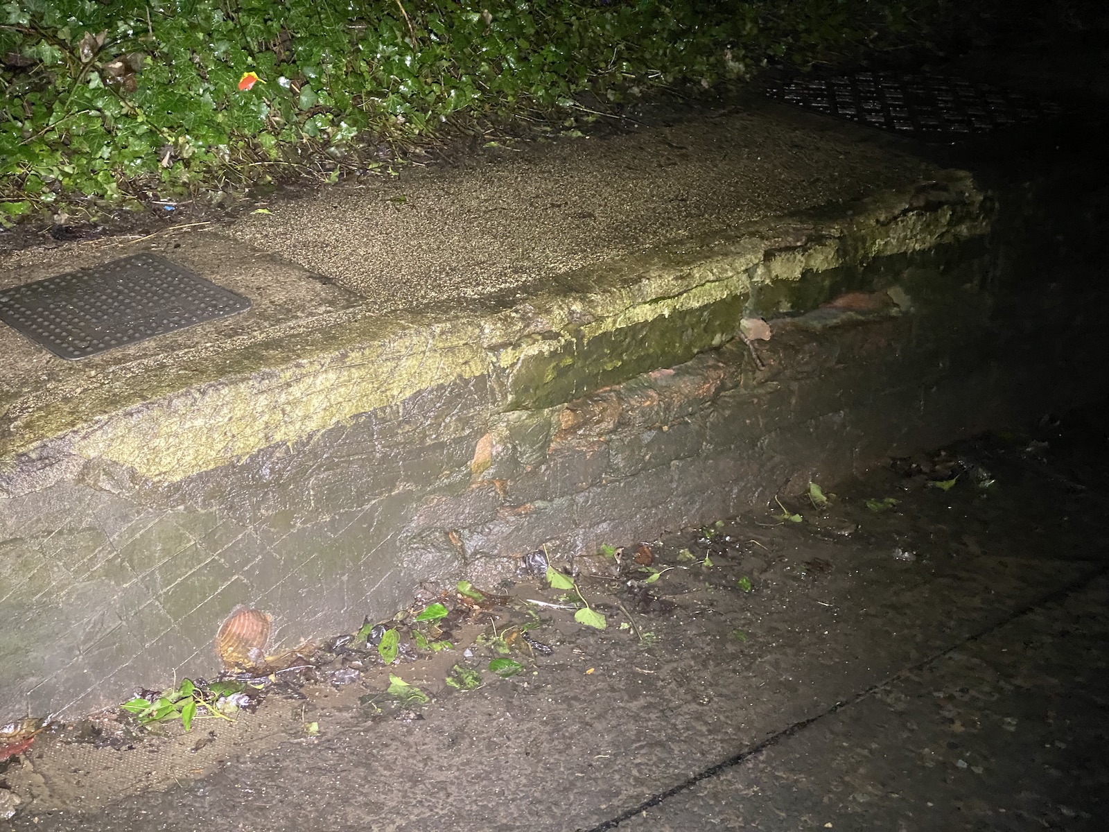
5.2 Drainage channel across edge of Spud Wood
Removal of silt (partially cleared in Jan 2021, partially cleared in Jan 2020)
Likely that recent de-silting may not be sufficient - entire length does not appear to be receiving maintenance
cage around drop to culvert.
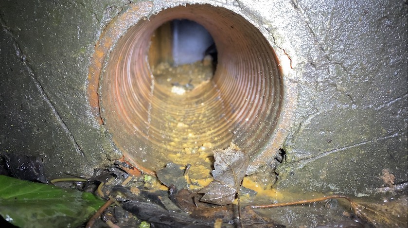
Culvert beneath aqueduct (assumed in good condition) - video shows culvert is not at capacity
responsibility? Woodland Trust site manager furloughed as at Jan 2021?
5.3 Gullies beneath aqueduct, drainage to culvert
Silted up? (as at Feb 2021)
regular road sweeping needed (before & after heavy rain)
Maintenance of above ground existing pipes into culvert (check)
Option for further drainage (see s. 7 for inspiration)
6. Mitigations (controls to reduce damage when aqueduct floods)
Anecdotal - majority of vehicles are damaged travelling from Burford Lane towards Mill lane. Drivers 'pressured' by vehicles behind
Active signage - Mill Lane - how is this triggered, can we improve (not clear if it's working, appears to remain 'on' - Mill lane sign) for extended periods - weeks.
Active signage - Burford Lane - remounted on post in February 2020, removed between 18/10/2020 & 05/11/2020 - plans & timescales?
Active signage - status of system - sensor working? is this reporting to WBC? Who has responsibility? (it's been out of action for years - bit of a missed opportunity - we can prevent this failing going forwards)
Signage sensor location?
Signage - sensor water access
Flood depth gauges - in feet (really?!) - Mill lane side cleaned Feb 2020, Burford Lane side damaged & removed (2018 or earlier)
Possible option for rainfall based alerting
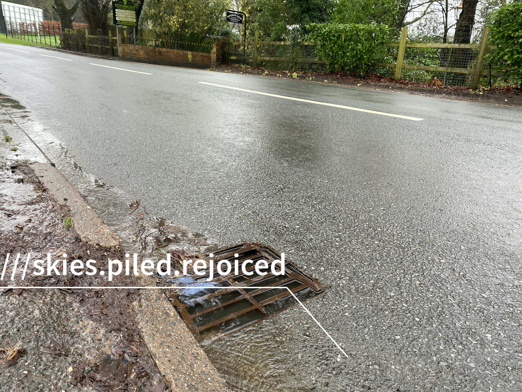
Is there a maintenance / cleaning schedule after flooding (e.g. the drainage system beneath the aqueduct appears silted up, the most recent flood took a while for the water to clear), as well as the obvious:
- highway cleaning
- Clearing of silt fished out onto the pavement above the gullies
- check for sensor apparatus silting up etc.
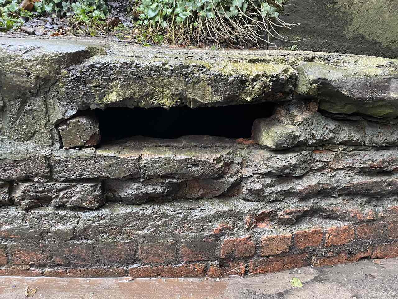
7. Damage to brickwork
- Missing bricks to brickwork below footpath
- Keeping water level to below footpath
- Keeping water level below designed emergency drainage (both sides)
- Gives an indication of the additional water removal capacity required (issue with debris blocking road surface based drains)
- Challenges of listed structure?!
Damaged brickwork - February 2020:
8. What can we do better?
!!